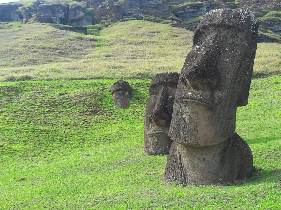
PICTURED: The Moai heads of Rapa Nui, or Easter island. CC 4.0.
Story at a glance…
-
A new genetic map tracking the eastward populating of Polynesia has been constructed by scientists.
-
Looking at genes unique to each island, and excluding outside influences, allowed for precise path and dating.
-
The work joins a rare agreement between the oral history, genetic, and archaeological evidence.
Oceania, which includes the cultural landscape of Polynesia, was the last settled area of the Earth. Obviously owing to the vast size of the Pacific Ocean, a body of water that covers a third of the planet, it took sometime before humans peopled all of the various islands stretching from Formosa in the west to Easter Island in the east.
Stemming from their isolation and monopoly on trade, the genetic and archaeological timelines of the settlement of the Pacific Islands overlap in a rare display of anthropological unity. Now a broad spectrum of researchers have contributed a genetic timeline of this colonization, tracking the movements of peoples as they spread out across the vast open ocean.
430 living individuals across 21 key island locations made up the map, whose genetics were characterized by non-Asian derived mutations, and which were subject to machine learning to obscure European genetic intrusions. Rare island-specific mutations were identified, and tended to rarely travel to lands beyond, thus giving a very localized profile which gave the team an exceptional clarity of being able to see who went where, and when.
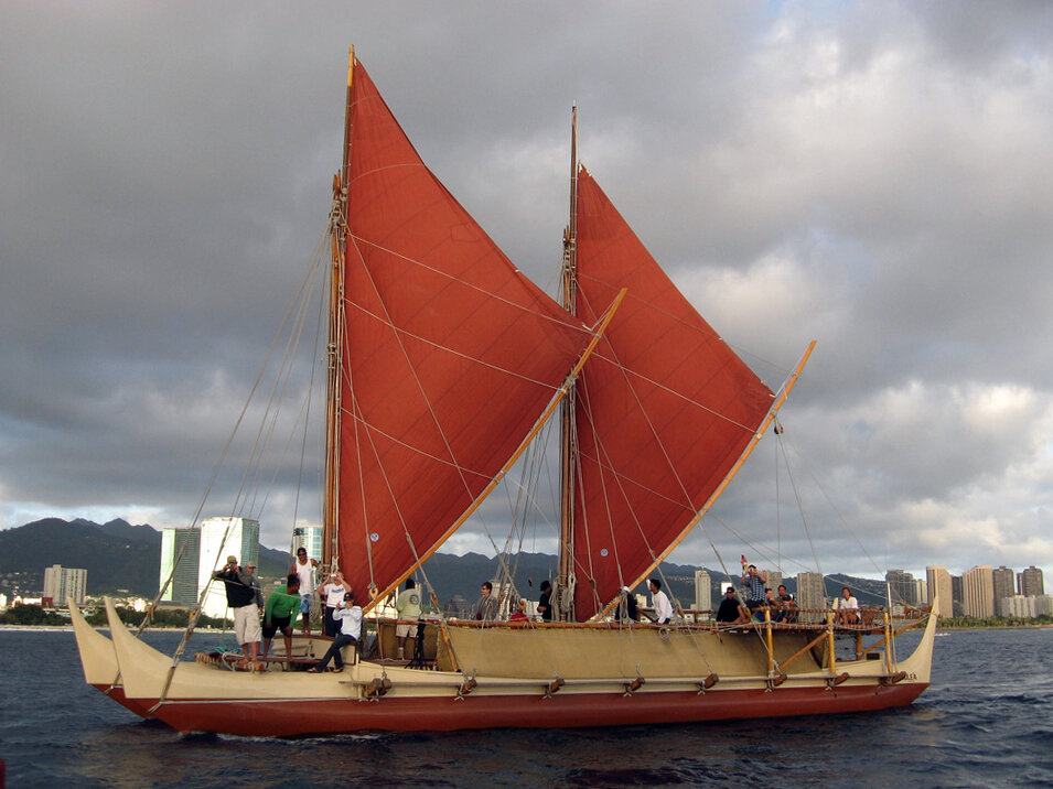
Unique in so many ways, the Polynesians have a shared culture characterized by many different aspects, from tattoos to surfing to giant megalithic stone carvings. Their double-hulled canoes and exceptional knowledge of the stars, wind, sea, and bird migrations allowed them to travel vast distances without being sure of existence of the land they were searching for.
PICTURED: Hōkūle`a, a modern Hawaiian wa’a kaulua or voyaging canoe, sailing off Honolulu. PC: Hong Kong Luey. CC 2.0.
Trial of genes
With a heritage described as Austronesian, the earliest ancestors lived on Taiwan and New Zealand, and travelled first to Samoa, Tonga, and Fiji around the time of King Charlemagne. From there, a branch of people embarked on a 1,500 kilometer (1,060 mile) voyage to the Cook Islands, or Rarotonga.
By the time of William the Conqueror, or around 1,050, the Polynesians had reached the Society Islands, where modern-day vacationers would find Bora Bora and Tahiti. By 1,110 they reached Palliser, or Mataiva. 30 years later Mangareva was populated on the eastern quadrant of the Polynesian Triangle, and northward they went to the South Marquesas, arriving in 1,140.
Back westward, population dispersions in 1,190 on previously-settled islands would arrive at Rapa Iti, 1,700 kilometers to the south, and Aitu and Mauke in the Cook Islands. 20 years and 2,600 kilometers later, the Polynesians would settle “Rapa Nui” or Easter Island, 6,640 kilometers from where the long journey began in Samoa. It was not until the 1300s that all of the Pacific Islands were settled.
By now the people who arrived on Easter Island’s shores were different from those who left Samoa’s. As can be seen in the inter-island shared haplotype distribution in the paper, very little genetic material from the far western Polynesians had made it across the ocean and span of years.
“The first arrivals to these isolated island groups are thought to have experienced rapid initial growth, driven by the abundant resources of unfished reefs, huge seabird colonies and flightless birds (that soon became extinct) unhabituated to humans,” the researchers write. “These rapidly expanding island populations then initiated new voyages of exploration in search of— according to some theories—further untapped resources, a model supported by early oral histories”.
“We confirm this hypothesis—that the genetic composition of each remote island group is dominated by the contribution of its founders, whose descendants rapidly populated it”.
What did make it over from Samoa was the basalt rock adze, a tool of paramount importance to the Polynesian society, as it allowed them to fell trees and dig out their canoes. The Tutuila quarry on Samoa has produced stone adze tools found on islands as far west as the Marquesas, a distance of more than 2,400 kilometers.
This supports evidence of inter-island trade, but also of a general west-east pattern of expansion, and really reinforces a clear picture of the peopling of Oceania, as clear as any mass movement of peoples ever recorded.
Continue exploring this topic — Anthropology — Like Jefferson, Scientists Help Demonstrate Pygmies’ Natural Rights to Ancestral Lands Given Over to Logging
Continue exploring this topic — Archaeology — “Dazzling Aten” — a ‘Lost Golden City’ has been Uncovered by Egyptologists
Continue exploring this topic — Archaeology — Stonehenge Was Likely Built From Other Cannibalized Stone Circles in Wales
